UNITRANS
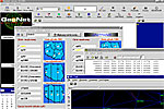
System is "open" to external programs thanks to ASCII input-output files. Special tools allow to create coordinate grids and functions, binding national systems with local ones. If we have already prepared digital maps in local systems, wanting to convert them to different systems, we can take advantage of unique applications performing automatic conversion of dgn files with observance of K-1 instruction requirements (Task is carried out with the help of independent N-Trans application)
In addition to coordinates being transformed, an important cartographic information is local distortion field components (it is a pity that such information was not included in map certificates-this would have caused much confusion between the surveyor and the map user!). An important addition to cartographic systems are altitude systems. Program allows to convert normal height values to ellipsoidal (WGS-84), or vice versa, using digital geoid model or polynomial interpolation methods.


